

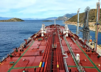
Pachi – Crude Oil Terminal (Helpe Installations) is the one with the largest capacity in Greece for crude oil, belonging to the most important company in Greek Energy industry, Hellenic Petroleum.
Live map by MarineTraffic
General Description
| UN/LOCODE: | GRMGR |
| Coordinates: | 37°58’30”N / 23°23’E |
| B. A. Nautical Chart No: | 1598, 1513, 1657 |
| Admiralty Sailing Directions: | NP28 |
| Time zone: | UTC +2 hrs |
Hellenic Petroleum Crude Oil Berth:
- Pilotage and Tugs are compulsory
- The Terminal has a direct approach from open deep sea waters of the Saronic Gulf
- There are no LOA/Beam restrictions and tankers of 20.000 – 600.000 DWT can be accommodated, berthing alongside usually on starboard. Ship mooring lines are always used
- Max draft 29 m
- Sea water density about 1025
- Shore manifolds 4 x 16 inches, but 3 are in service
- Average cargo rate 3000cbm/hour per loading arm at max back pressure 8 kgs/cm2
- Max flow rate 4000 cbm/h
Anchorage Areas
Deep drafted anchorage is located SW of North Pachi island and can accommodate up to 3 tankers at all times.
Port Restrictions
Berthing/Un-berthing is prohibited when winds exceed 6 bf.